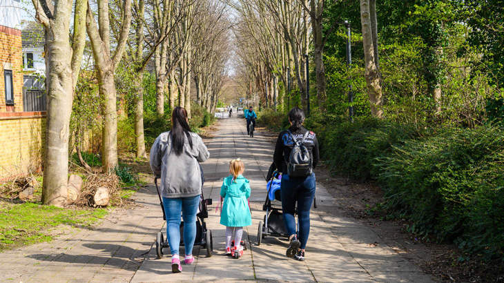
Escape the bustle of south-west London and discover peaceful parks and green spaces linked by the Wandle trail. Look out for clues to the river’s long industrial past, artworks inspired by the route, and spot wildlife in the city.
For a relaxed family cycle ride or if you use a wheelchair, handcycle or pushchair we recommend King George’s Park, and the section between Earlsfield and Poulter Park.
Information on this page
- Places to see and explore
- Local amenities
- Public transport
- Local loops
- Continue on the National Cycle Network
- Continue walking
- Accessibility information
Places to see and explore
- Explore the industrial history of the Wandle which powered 100 mills during the industrial revolution
- See a working water wheel at Merton Abbey Mills and find out more at the Wandle industrial museum in Mitcham
- Spot wildlife in the city at local nature reserves and wetlands along the Wandle Valley such as Wandle Meadow nature park, Ravensbury Park, Watermeads Nature reserve and Wilderness Island
- King George’s Park
- Deen City Farm
- Morden Hall Park, a National Trust property (free entry to parklands)
- Oaks Park
- Bright purple sights and scents in summer at Mayfield Lavender Farm (paid entry)
- Stunning views over London from the chalk downlands of Farthing Downs
Local amenities
- Wandsworth, Earlsfield, Colliers Wood and Morden: local shops and services
- Merton Abbey Mills: shops, bars, restaurants and weekend market
- Deen City Farm: Brioche Farmhouse café and toilets
- Morden Hall Park: Potting Shed café and toilets
- Morden Road: Surrey Arms pub
- Ravensbury Park: River Side café
- Westcroft Leisure Centre café and toilets
- Carshalton local shops and services
- Oaks Park café and toilets
- Mayfield Lavender farm, Banstead: seasonal café (paid entry)
- Woodmansterne village: The Woodman Pub and local shops
- Coulsdon: local shops and services
- Farthing Downs car park: toilets

Isabelle, South London
I had a wonderful 20km hand bike ride through South London on the National Cycle Network's Wandle Trail, to Merton Abbey Mills, on to Beddington and back.
I was nervous about path accessibility on these routes but was actually happily surprised!
Public transport
By train: Wandsworth Town, Earlsfield, Haydons Road, Mitcham Junction, Hackbridge, Carshalton, Wallington, Woodmansterne, Coulsdon Town, Coulsdon South
By tube: Wimbledon Park, Colliers Wood, Morden
By tram: Morden Road, Phipps Bridge, Belgrave Walk, Mitcham, Mitcham Junction
By river: Wandsworth Riverside Quarter pier
Find out more about using public transport to get to the National Cycle Network on our Get started on London’s National Cycle Network page.

Local loops
We recommend these local circular routes for family friendly, traffic free and accessible adventures.
- This 1 mile King George’s park pootle in the heart of Wandsworth town is flat and traffic free
- This 4 mile circular Wandle Trail route is flat and traffic free and takes you to Merton Abbey Mills, Morden Hall park and Ravensbury Park.
Continue on the National Cycle Network
Want to explore more of the National Cycle Network from this route?
Follow these directions to find other National Cycle Network routes near here:
From Wandsworth Town cross Wandsworth Bridge to join the Thames Path eastbound to Tower Bridge and Greenwich on Route 4.
From the mouth of the Wandle, follow the Thames westwards through Wandsworth Park to connect with the Thames Path from Putney to Hampton Court on Route 4.
Take a short hop west to join Route 208 between Wimbledon and Sutton Common.
At Woodmansterne join Route 22 to the Surrey Hills and Portsmouth
At the M25 join Route 21 south to Reigate, Crawley and Eastbourne or north towards Greenwich on Route 21.
This route forms part of the Avenue Verte route between London and Paris.
Continue walking
Want to explore more of London’s walking network from this route?
Find out which other routes you can join from Route 20:
At the Thames join the Thames Path National Trail eastbound or westbound (south bank route).
At Earlsfield join the Capital Ring eastbound or westbound.
Join the London Loop westbound at Coulsdon or eastbound at Farthing Downs.
Join the North Downs Way National Trail at Chaldon.
Find more useful information about walking in London on our ‘Get started on London’s National Cycle Network’ page.

Accessibility information
Between Wandsworth and Carshalton, this route is mostly suitable for relaxed leisure walking, cycling and wheeling. This information focusses on this section.
South of Carshalton, this route is mostly on road and is suitable for people who are confident cycling on road.
Barriers
At King Georges Park, the southern entrance at Acuba Road is narrow. There is a wider entrance at Knaresborough Drive.
At Holmes Road, there are bollards with a narrow gap, if using a wider mobility aid you may need to use the pavement.
At Morden Hall Park tramline crossing, there are two chicane barriers.
At Poulter Park, there is an A frame barrier just north of Watermead lane with 60cm clearance at waist height and 90cm clearance at foot height. There are two chicane barriers just south of the Middleton Road crossing.
At Culvers Avenue, there two chicane barriers.
Beside Croydon Lane between Oaks Park and the Lavender Farm, there is a gate, 100m of narrow rough path and a narrow entrance.
On Farthing Downs, there are two cattle grids.
Surface
Between Deen City Farm and Morden Hall Park, paths are hard packed gravel.
Within Morden Hall Park, paths are hard packed gravel.
Beside Croydon Lane between Oaks Park and the Lavender Farm, there is a narrow rough path for 100m.
At Woodmansterne, Hatch Lane is a hard packed woodland path for 500m.
Steeps and steps
South of Carshalton, the route undulates towards the North Downs.
Take care
This route has these busier on-road sections.
At Wandsworth Town, this route uses busy local Ram Street and Garratt Lane (A217) for half a mile. Take care crossing the very busy A205 and A3.
At Earlsfield, the route uses busy local Garratt Lane (A217) for 150m.
At Hackbridge Road (B277), the crossing is not signal controlled.
In Carshalton and Coulsdon, the route uses busy local roads Park Lane, Carshalton Road, Manor Hill, Grove Lane, Woodmansterne Road, Brighton Road and Marlpit Lane. Users of this section should be confident cycling on roads.
Please note
We have taken all responsible steps to ensure that these routes are safe and achievable by people with a reasonable level of fitness.
However, all outdoor activities involve a degree of risk. To the extent permitted by law, Sustrans accepts no responsibility for any accidents or injury resulting from following these routes.
Walking and cycling routes change over time. Weather conditions may also affect path surfaces.
Please use your own judgement when using the routes based upon the weather and the ability, experience and confidence levels of those in your group.


